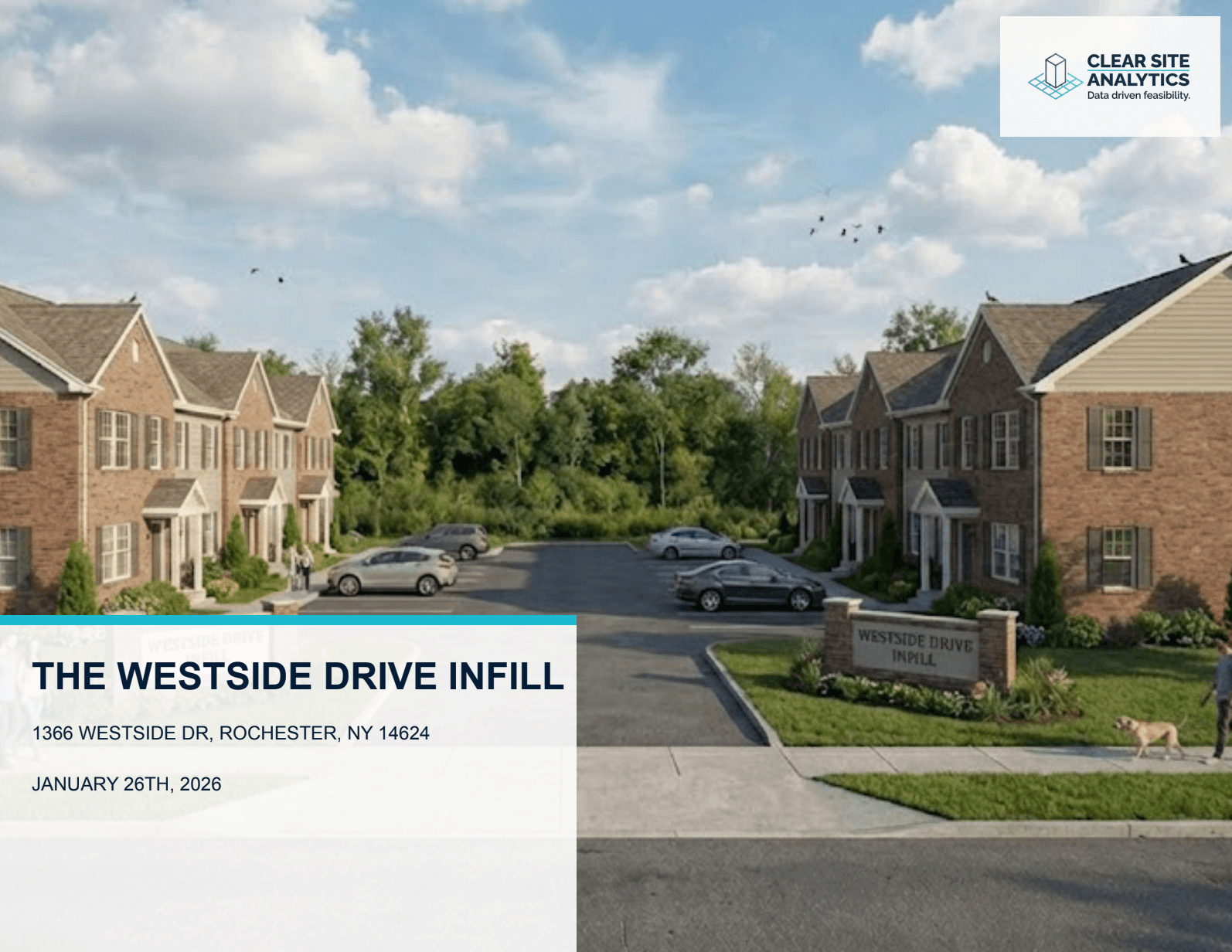
The Westside Drive Infill
0.96 Acres
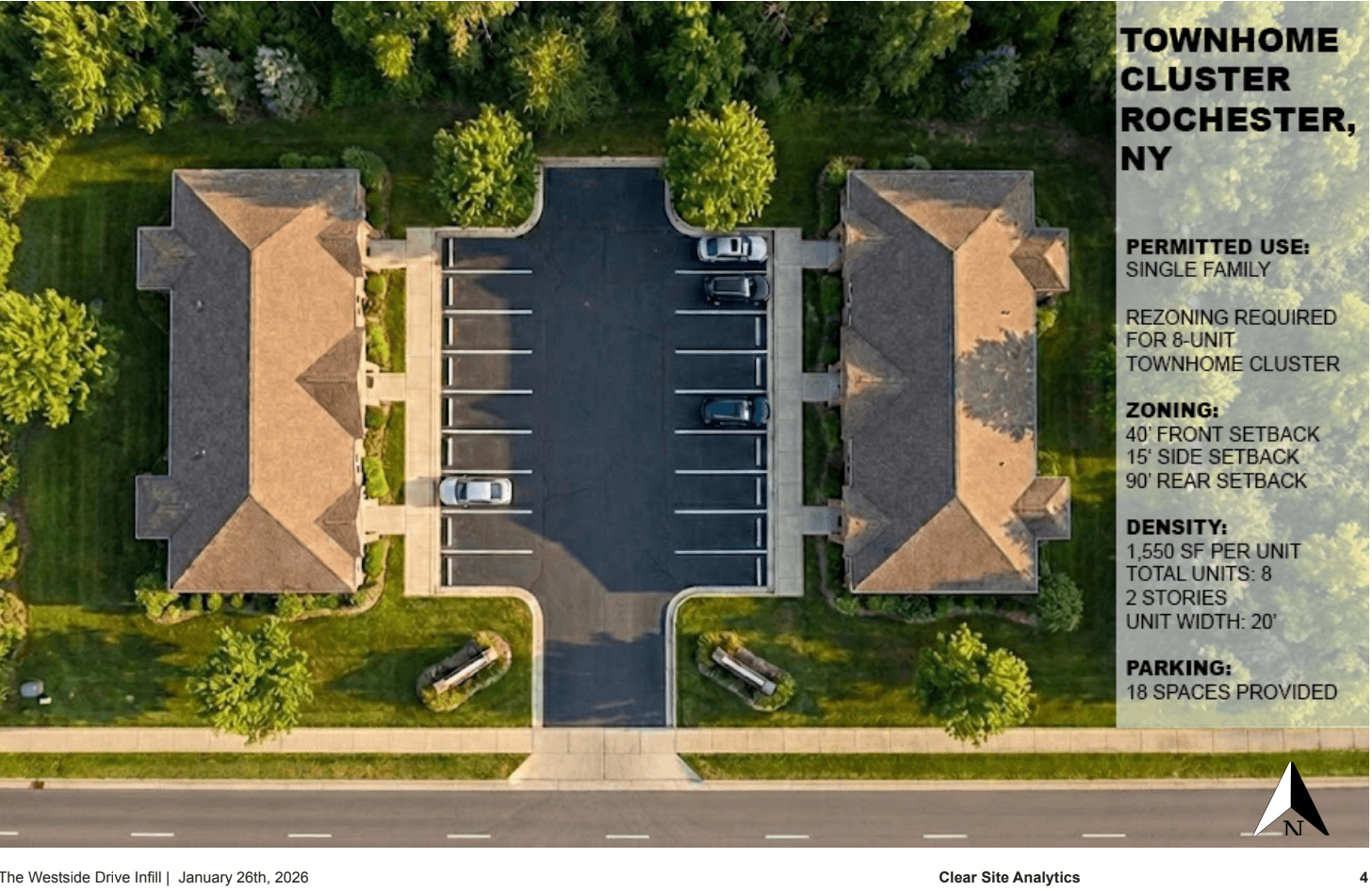
8 Townhome Units
Residential Townhome Cluster
Executive Summary & Site Context
Objective:
To determine the maximum viable residential density for a challenged 0.96-acre parcel in the town of Gates. The primary objective is to balance density with significant environmental constraints.
Site Strategy:
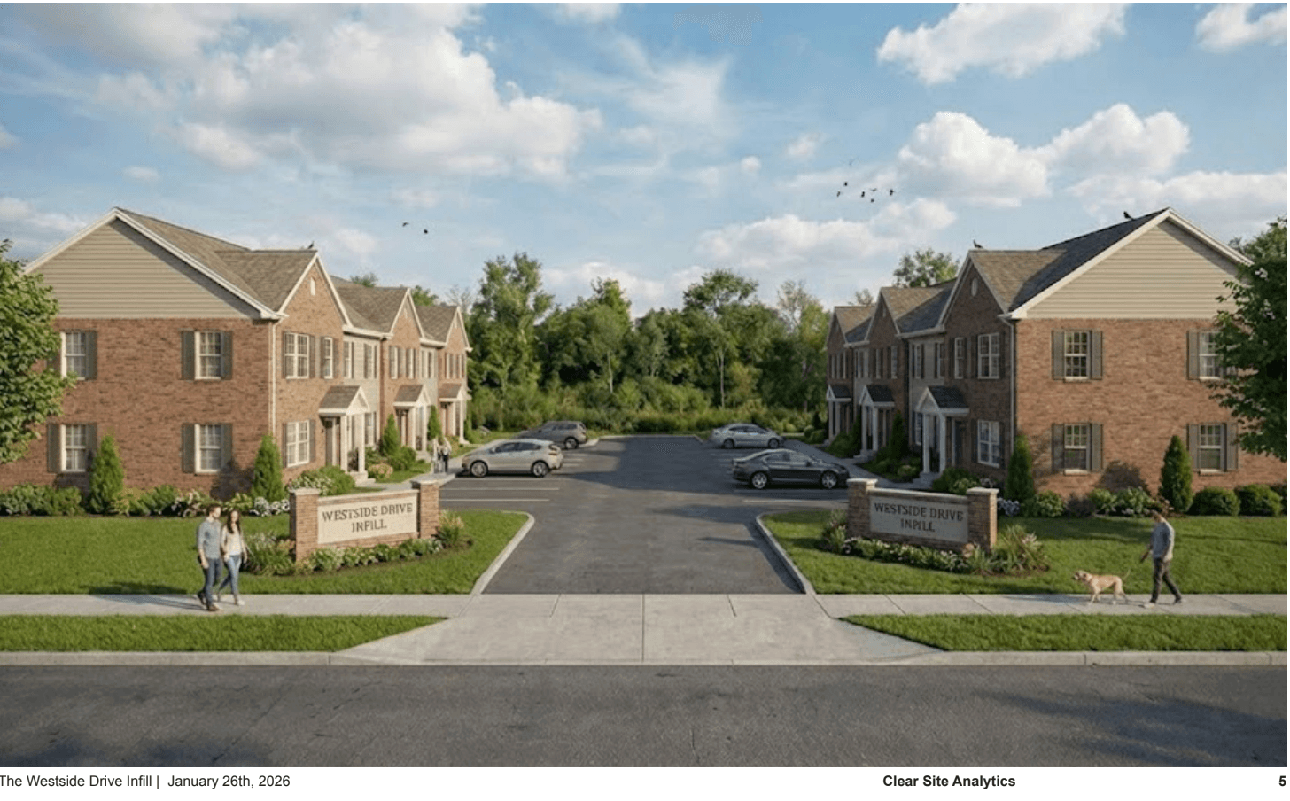
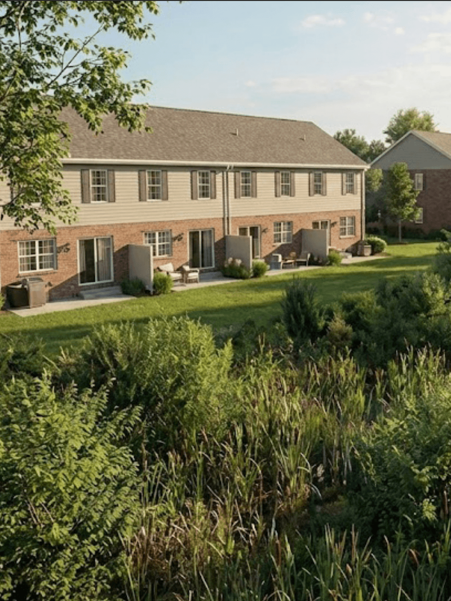
The proposal introduces a cluster of 8 "Rowhouse-Style" townhomes positioned on the front 60% of the lot. The massing is organized into two symmetrical blocks of four units flanking a central drive. This layout avoids all encroachment into the NYS DEC Protected Wetland Buffer located at the rear of the property, turning a site constraint into a natural amenity.
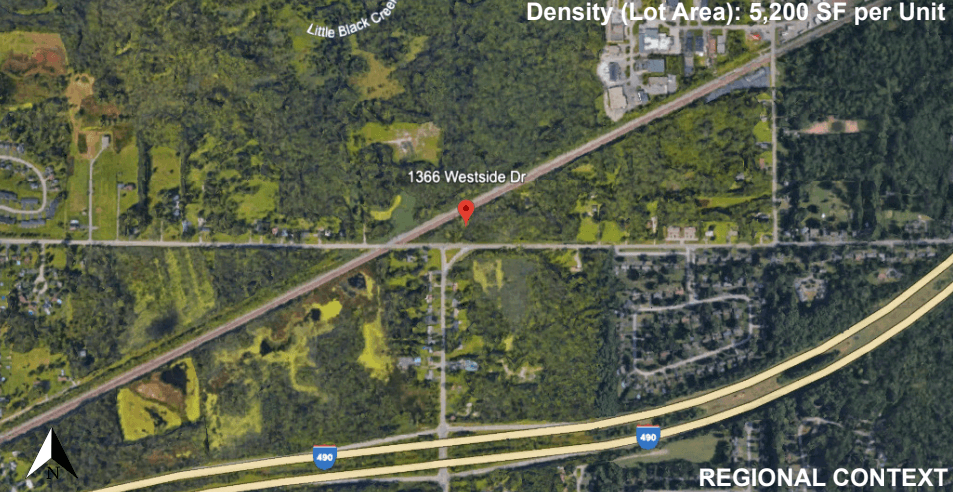
Context:
- Neighborhood: Gates / Rochester Border (Suburban transition zone)
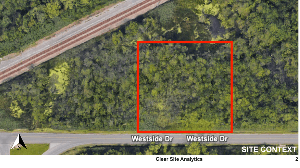
- Site Condition: Deep lot (approx. 160' x 260') with environmental overlay at the rear
Executive Summary
Zoning Analysis
Feasibility of rezoning/variance strategy (Current Zone: R-1 Residential)
| Regulation | Code Requirement | Proposed Design | Status |
|---|---|---|---|
| Permitted Uses | Single Family | 8-Unit Townhome Cluster | Variance Required |
| Density (Lot Area) | 2,500 SF per Unit | 5,200 SF per Unit | Compliant |
| Front Setback | 35' Minimum | 40' Provided | Compliant |
| Side Setback | 10' Minimum | 15' Provided | Compliant |
| Rear Setback | 30' Minimum | 90'+ (Due to Wetlands) | Compliant |
| Parking Ratio | 2.0 Spaces / Unit | 18 Spaces | Compliant |
| Environmental | 100' Wetland Buffer | Structure is outside Buffer | Compliant |
Data Sources: https://ecode360.com/8679474
Site Requirements
Zoning Analysis
Site Concept & Massing
"Clustered density" approach maximizing buildable area while preserving environmental features
Site Concept
Site Concept
Massing & Visualization
Massing & Visualization
Key Design Features
Clustered Density
8 rowhouse-style townhomes on front 60% of lot, avoiding wetland buffer
Environmental Integration
Protected wetland buffer preserved as natural amenity and privacy feature
Symmetrical Massing
Two blocks of 4 units flanking central drive for optimal site utilization
Enhanced Parking
2.25 spaces per unit (18 total) meets suburban market demands
Unit Specifications
Operational Capacity
Unit Specifications & Marketability
Operational Analysis:
The site plan utilizes a "clustered density" approach. By grouping the units near Westside Drive, we minimize the length of the utility runs and pavement, significantly reducing infrastructure costs compared to a traditional deep-lot subdivision.
- Open Floor Plan: Kitchen/Dining/Living on first floor
- Rear Patios facing protected wetland buffer
- Second-floor laundry closet
Unit Specifications
Variance Note:
While the density fits the lot size comfortably, the project assumes a rezoning from R-1 (Single Family) to R-Townhouse or a Planned Unit Development (PUD) approval, leveraging the preservation of the wetlands as a "public benefit" in exchange for density.
Investment Summary
The Opportunity
1366 Westside Dr is often overlooked due to its wetland designation. This study demonstrates that the front 0.6 acres are fully buildable. By acknowledging the environmental constraint immediately, the proposed 8-unit cluster creates a viable "pocket neighborhood" with lower land costs than competing sites.
The Path Forward
The wetland buffer has been respected. The density is proven. The next step is execution.
Clear Site Analytics, LLC
Alexander Panzera
apanzera@clearsiteanalytics.com
585.755.5772